Death Valley, California, USA (May 2017)

Having driven past the signs for Death Valley several times on our way to Las Vegas, this is a destination we have always wanted to visit but were discouraged due to the extreme heat. According to the nps website it can reach 120F (49C) on a summer’s day and others claim this to be the ‘hottest place on earth’.
When we were planning 3 nights in Las Vegas for May 2017 and considering new places to experience during the day, I wondered if being Spring, this might be an ok time of year to visit Death Valley? We only had one free day due to other attractions we wanted to see around Vegas, so I started researching to see if a day trip would be possible. I was pleased to learn it was a manageable 2 hours drive from Las Vegas to Death Valley Junction and that you can visit quite a few of the ‘must see’ popular spots in one day. Although I also discovered that even though we would be going in early May, it could still be quite hot… low 100’s!
We decided to go for it, and thanks to research and careful planning, this turned out to be a successful trip. However, I will say straight up, while it is possible to visit as a day trip from Las Vegas, there is a lot to see in Death Valley and if you truly want to appreciate this national park and intend to do some hiking, you should consider an overnight stay or two.
Fortunately, it all worked out and turned out to be a very enjoyable, although long, day. We made it to all but one of our planned stops.
This was our route plan:
Las Vegas – Dante’s View – Stovepipe Wells Village (lunch) – Mosaic Canyon – Mesquite Flat Sand Dunes – Golden Canyon – Devil’s Golf Course – Badwater Basin – Artists Drive – Furnace Creek – Zabriskie Point (sunset) – Las Vegas
We originally planned to also include Natural Bridge but ended up skipping it – will explain why when you read on.
My top 5 tips
Before telling you about our day trip, let’s start with my top five tips for anyone considering going to Death Valley:
- Stock up on bottled water before you go – if it’s hot you will go through it.
- Top up the fuel tank before entering the park.
- Download a map before you go. There’s no GPS (or phone) reception. If you forget, don’t worry, there’s quite good signage and you can apparently pick one up from Furnace Creek Visitor Centre.
- Bring your camera – fully charged.
- Don’t forget your sunglasses, sunscreen and lip balm. The sun almost always shines and it can get quite breezy.
Our route from Las Vegas
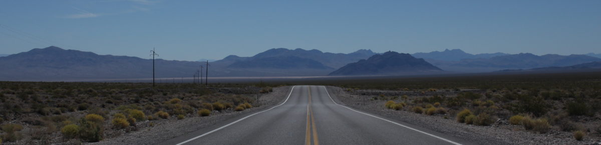
Death Valley is located north west of Las Vegas. I read some reviews describing the drive there as boring, however we thought it was beautiful and scenic.
Being on holidays, I wasn’t keen on making too early a start, despite the ambitious number of places we wanted to see. I reasoned that we could get away with starting out around 7.30-8am, because we weren’t planning on doing any real hiking, due to the heat and our dodgy knees.
We left Las Vegas on Tuesday 2nd May at around 8.30am, a bit later than I wanted, after sleeping in following a late night. We were further delayed after needing a stop off at Starbucks on the way to our car to pick up some coffee for the road.
There are a couple of options of routes; we chose Highway 160 through Mountain Springs. We stopped at Pahrump for toilets and found a supermarket there – a good place to pick up an 8-pack of bottled water and some throat lozenges for the hubby’s sore throat. Then we topped up the fuel. All websites I read strongly recommended bringing lots of drinks and also filling the fuel tank before entering the park as facilities in the park are few and far between.

Just after exiting Pahrump, we found a sign to Death Valley telling us to turn off left onto Bell Vista Road. This took us over the border into California and finally, to Death Valley Junction. From here we simply followed the signs, onto Highway 190 into Death Valley.

I kept pulling the car over to take photos – the landscape was beautiful and diverse. Plus there were hardly any cars on the road – I guess this was a benefit of travelling at this time of year. Our many photo stops of course included the obligatory park entry sign plus there’s a stop point not far after where you can pay the $25 park entry fee (a self serve machine which I couldn’t help but notice other people around either bypassed or struggled with directions on how it worked – it really wasn’t that hard).
-
Dante’s View (11.30am)
Our first official stop was Dante’s View and thanks to good signposting, we found the left turn off easily. The drive up to Dante’s View is quite long, winding and steep in some parts. Nearer to the top, the bends get quite tight – too tight and narrow if you are in coaches or large vehicles so be prepared to park in a lower car park and walk up.
We finally arrived at the top around 11.30am where we found a car park and viewing point perched on the crest of the Black Mountains. There are also some short walking trails nearby, which we didn’t venture down – we were happy to absorb the spectacular panoramic views across the Valley from the viewing point by the car park.


We found it much cooler up here compared to down in the valley. It was around 77F (mid 20’s C) at the top with a welcome breeze, providing a perfect temperature setting. We could see down into the Badwater Basin, across to the Panamint Mountains and as far as Furnace Creek and beyond. This was partly why I chose this as our first stop, to give us our bearings and an idea of the immensity of the national park. We stayed for around 15 minutes, soaking in the views, admiring the nearby spring wildflowers and breathing in the fresh air, before taking the drive back down the mountain to head onto our next stop.
-
Stovepipe Wells Village (12.45pm)
I had planned Stovepipe Wells as our lunch destination, because I had read good reviews about their food (well, there was really only a choice between Stovepipe Wells and Furnace Creek).

It took about one hour to drive from Dante’s View along route 190 to Stovepipe Wells Village. Again, we drove through some beautiful scenery past Furnace Creek, Salt Creek, Devil’s Cornfield and Mesquite Flat Sand Dunes.
We arrived at Stovepipe Wells Village around 12.45pm. We were quite hungry, especially as we’d only had coffee for breakfast, although we’d had a very late meal the night before, with huge Vegas style portions.

The reviews were spot on. Stovepipe Wells Village was gorgeous, consisting of some ranch style accommodation with a pool and a gift shop. There was also a general store and petrol station across the road. We found their restaurant, “Badwater Saloon”, and even though only a very short walk across the car park, upon entering the Saloon, the air conditioning we were hit with was very welcoming, as the temperature was quite hot by now.

Looking around at the décor we knew we’d made a good decision, this was a great place to stop for lunch. It was like being at an old ranch from a hollywood movie. The waitress service was really friendly and whilst at that point we probably would have eaten anything, we were extremely pleased to find a menu with some healthy options (and inventive names of items). We ended up choosing a “Keane Wonder Mine Angus Cheeseburger” and a “Death Valley Southwest Wrap” – both were tasty and fresh, arriving with a pile of hot chips. We stayed for almost an hour, bought some souvenirs (coffee mugs and shot glasses) then ventured back out into the heat which was rising. We stopped across the road for refuelling – highly recommended here as, like food options, there aren’t many fuel options in Death Valley either.
-
Mosaic Canyon (2pm)
Next we headed 5 minutes up the road to Mosaic Canyon. While reasonably close to Stovepipe Wells Village in distance, it took us ages (it seemed) to drive up the 3.7km (2.3 miles) of unpaved dirt road. It was very bumpy with lots of loose stones and being in a rental sedan we were quite stressed we were going to hit a pothole and get a flat tyre or get a chip in the windscreen while passing another car. So we took it slowly, my knuckles white, gripping the steering wheel. We were relieved when we finally made it to the car park at the Canyon entrance and temporarily put it out of our minds that we had to go back down that same road to get out!

Initially I was thinking of an hour walk here (30 mins in plus 30 mins back) but we were a little behind schedule with lots more to see. Plus it was frankly getting too hot – around 104F. Leaving the hubby, who hates the heat, in the air-conditioned car, I walked in on my own, camera in hand, for about 10-15 mins before turning back. I was able to get far enough in to where the canyon narrowed and I could admire the smooth marble like canyon walls. I stuck to the sides of the canyon for shade as much as I could but stupidly had forgotten my water bottle so my mouth was really dry towards the end of my walk. This canyon offered some really beautiful rock formations and if it had been cooler I would have loved to have gone further. Unfortunately, the energy absorbing heat was too much for me to bear so I was keen to get back to the air conditioned car and our stash of water bottles.

-
Mesquite Flat Sand Dunes (2.35pm)
Next we doubled back along the road we had come in, past Stovepipe Wells Village and stopped at the Mesquite Flat Sand Dunes for 10 mins. We had driven past on the way to Stovepipe Wells so had a preview but when turning off the road and into the car park I was surprised at how dark the sand was. As I got out and took a short walk into the dunes I realized upon closer inspection there were tiny gold speckles glistening in the sand, which was probably what gave the sand its darker colour.

There were some dead branches and small shrubs in the dunes near the car park but if you ventured further out in some places there were expansive dune hills where you could be surrounded by sand alone. For me though, it was a bit too hot for wandering farther and we had a tight schedule. Plus, I wasn’t too keen on getting sand in my shoes! So we jumped back in the car and headed on to our next stop.

-
Golden Canyon (3.15pm)

Stop – Extreme Heat Danger (No kidding)

We drove back past Devil’s Cornfield, Salt Creek and Furnace Creek and turned off right onto Badwater Road to arrive at Golden Canyon soon after. It was another short walk for me on my own but this time I remembered the water bottle, thankfully, as the temperature was still climbing – now at 106F.
 Once again, it was really beautiful scenery, although quite different to the previous canyon. It still had the narrowing twists and turns and ups and downs but the rock formations were a different texture and colour.
As I gazed around, the scenery looked familiar and I later realized this was where the original Star Wars Episode IV (A New Hope) was filmed – where R2D2 was being followed by the Jawas before meeting Luke Skywalker. This was confirmed by some additional research I did when I got back home.
I kept to the walls for shade again and walked in for about 15 minutes and far enough to see the landscape change. I had read that there is a trail that goes all the way to Zabriskie Point but it was too hot and there wasn’t enough time to go all that way. I think I found Red Cathedral, though – it certainly fit the description.

-
Devil’s Golf Course (3.45pm)
This stop, just a bit further on from Golden Canyon, involved a right turn off Badwater Road and another drive down an unpaved road. It was just as scary as the last drive, down near Mosaic Canyon, but we made it ok to the end. Named the ‘devils golf course’ because “only the devil could play golf” on its surface, due to a rough texture from the large halite salt crystal formations, it was definitely worth the stressful drive down that road. It was a site to behold – the texture of the ground was unlike anything I have ever seen before! It looked like a ploughed muddy field with a crusty salt top. The photos don’t do it justice.

So enthralled crouching and looking down at all the different shapes and crevices, I almost didn’t look up. I’m glad I did as the views of the mountains to the east behind us were spectacular, displaying beautiful colours, lines and formations.

-
Badwater Basin (4pm)

A little further along Badwater Road, past Devil’s Golf Course, you will find Badwater Basin, the lowest point in north America – 85.5 meters below sea level. Did I mention it was Hot! By the time we arrived the temperature had climbed to 108F (42C) but it felt so much hotter! I guess this was due to the sun reflecting off the accumulated salts surrounding the area, which are known as the salt flats.

We found a small spring of water near the car park, which apparently contains plant and animal life. The salts in the area make the water undrinkable, hence the name ‘Badwater’. It was funny watching a few people bend down and scoop some salt or water with their finger and then lick it, only to pull a funny face.
I walked out as far as I could, further than anyone else. I was trying to find some ground which hadn’t been squashed down with footprints, so I could take some photos of the undisturbed salt cracks. It wasn’t a very good decision, because even though I had a water bottle (which I nearly drank the whole lot), I got so hot and dehydrated walking back to the car I nearly passed out. My face was like a bright red tomato, much to hubby’s amusement.


-
Artists Drive / Artists Palette (4.45pm)
We turned back on to Badwater Road heading back in the direction of Furnace Creek. We decided to skip the nearby Natural Bridge, mainly due to the access being via another unpaved road – we thought we’d been twice lucky and didn’t want to push our chances. So we turned off and went straight to Artists Drive to see Artists Palette. This is a great one-way 9 mile loop road, which looked to have been recently re-surfaced.


It involved a leisurely and extremely scenic drive for about 20-30 minutes through pretty hills, canyons and desert. It was a stunning drive and provided beautiful views from the air-conditioned car – greatly appreciated after the last stop at Badwater Basin nearly did me in.
Even though I was driving, there were very few other cars around so I was able to go slow and admire the views plus there are plenty of areas you can pull over for photos. The different colours on the sides of the series of hills were really beautiful – I read somewhere the pastel hues are coloured by oxidation & weathering. Also amongst the rocky desert, we were surprised to see many spring wildflowers, in yellows and different shades of purple, mauve and silver.

-
Furnace Creek (5.30pm)
As we drove on to Furnace Creek we saw more unique desert landscape. We had to stop again for more photos when we saw these dark grey/black rocky boulder-stones and natural sculptures. They were a different type and colour of rock from the other parts of Death Valley we had driven through, demonstrating the diversity this national park has to offer.

When we arrived at Furnace Creek we were not surprised to find the visitor centre was shut when we pulled up. To be fair, I had read they shut at 4pm but had hoped perhaps this was a mistake. So we drove over to the ranch/resort next door and stopped in at their gift shop to get some snacks and drinks and have a rest on one of the benches outside. They also had a bar and restaurant but we weren’t that hungry so after stopping for an hour we decided to head on to our next and final stop in time for sunset.
-
Zabriskie Point (6.30pm)

Just around the corner and about 5 minutes from Furnace Creek is Zabriskie Point. It’s nowhere near as high as Dante’s View, with the car park at ground level and a short walk up a hill to a lookout point. At first arrival in the car park I was a little disappointed, because I had expected it to be higher, however when I got to the lookout point I could admire the surrounding canyons; the shadowy ridge textures and colours were really beautiful. I set up my tripod and waited for the sun to set. I was glad we got there early as quite a few other photographers arrived and set up their tripods (I think I had claimed a pretty good spot)

Around 7.15-7.35pm the sky turned first a soft orange glow then some clouds in the sky got a little more orangey as the sun dipped below the mountains to the west.


A lot of people started to leave and as I turned to look behind me I thought how foolish of them as I noticed the sky turning pink and the colours of the rocky mountains behind me changed into stunning colours with the shadows emphasising the ridges.
We stayed longer and the sky transformed into the most beautiful array of pinks – one of the best sunsets I’ve seen in a long time.

We stayed until 7.50pm when the colours started to fade and we decided to leave before it got completely dark. As we left to head back to Las Vegas, the pinky–orangey sky continued, then faded in the rear view mirror behind us.
Route back to Vegas
Coming out of Death Valley National Park off the 190 at Death Valley Junction we took a different route, turning left onto 127 which turned into the 373 after crossing over the border into Nevada. It got very dark but was quite a quick route with only the odd vehicle on the road.

We came across Area 51 Alien Center at around 9pm just after we turned right onto Route 95 at Amargosa Valley, so we stopped in to have some fun browsing their quirky gift shop and bought some souvenirs.
We finally got back to Las Vegas around 10pm, with still plenty of time to find a late night restaurant in one of the nearby casinos for dinner.
It was a long day with lots of driving but well worth it. I highly recommend this day trip to anyone else venturing from Las Vegas. Although I’d suggest visiting earlier in the year for cooler weather, especially if you want to go hiking.
Also, if you are a Star Wars fan I recommend you check out this website for more info and self-tour details for the film locations in Death Valley: http://www.panamintcity.com/exclusives/starwars.html